Compare historical maps with modern terrain on Android devices
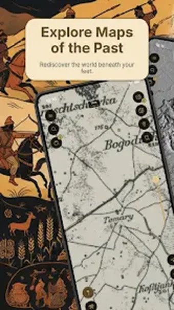
Overlays high-resolution historical maps onto contemporary satellite imagery, letting you stack up to four eras and adjust opacity for direct comparison. Old Ways: Maps Terrain, from Vadym Bezsmertnyi, targets history enthusiasts, genealogists, and hikers on Android devices. It combines georeferencing for user-scanned maps, offline map downloads for remote use, and terrain tools such as elevation profiles, forming a toolkit for exploring landscape change and locating vanished roads or settlements.
What the app does for historical location research
Old Ways focuses on placing historical cartography alongside modern maps so users can inspect landscape change. The app overlays historical map layers on satellite imagery and supports stacking up to four maps, with adjustable opacity for comparison. It also lets users import scanned maps and align them using the built-in georeferencing tool, which supports position, scale, and transformation adjustments for personal sources.
How precise and useful the terrain and measurement tools are
The app includes terrain features such as elevation profiles and relief exploration, which produce measurable outputs for route planning and landscape study. Distance and area measurements are available to quantify features found on historical maps, and elevation profiles draw a cross-section of terrain. These tools support fieldwork and desk-based analysis where a numeric sense of slope and distance matters.
Device compatibility, offline use, and workflow constraints
The app runs on Android and is designed for modern devices that handle high-resolution rendering. It allows downloading historical and topographic maps for offline use, so users can navigate without cellular reception. Georeferencing and multi-layer rendering occur on the device, which keeps imported maps local rather than streaming them to external servers.
Who it serves and what it does not do
The app suits historians, genealogists, urban explorers, and hikers who need historical context tied to present geography, especially when investigating old roads or changed river courses. The collection grows but remains specialised; full access to the map collection and advanced tools requires unlocking PRO or PREMIUM features, which limits immediate access to the entire dataset for casual users.
Valuable for specialist map research, limited by gated advanced access
The app provides a focused toolkit for anyone tracing historical geography on a mobile device, because it combines stacked historical overlays, georeferencing, and terrain analysis in a single Android app. Users seeking broad public map catalogs should note that full map access and advanced features require unlocking higher-tier features. It suits dedicated researchers and field explorers who need offline historical maps and measured terrain outputs.